Overview
Relative to fossil-based power sources, supply profile of many renewable electricity technologies is variable in intra-day, seasonal and inter-annual time scales and it varies site to site. Furthermore, a typical energy system has to serve a demand, that has specific time pattern, and it relies on a specifically located infrastructure whose potential expansion is constrained by complex economic, technical, and social factors. The interplay of all these aspects often results in site specific trade-offs between cost of renewable supply from a generator in question and the cost of infrastructure needed to develop the asset (e.g. roads) and connect it with the energy system (e.g. grid tie line). Therefore, a smart planning needs to distinguish renewable supply options more vigorously on basis of spatial and temporal characteristics in order to arrive at a least cost supply portfolio of future.
Underlying a robust energy transition planning, exists quantitative models that require data inputs often prepared through tedious process of complex computations (as elaborated in more detail by IRENA’s report on Planning for the renewable future). Absence of model ready datasets on renewables may delay such modelling efforts. Leveraging on the already rich open-source geospatial data, IRENA is producing pre-processed datasets on renewables that can readily serve the input data needs of energy system models. These datasets entail essential performance attributes that can compatibly serve as inputs to modeling tools of widely varying spatial and temporal modelling capabilities. Source codes developed to produce these datasets are made accessible to public to ensure re-producibility, transparency, further customization by end users and co-development opportunities.
Africa hydropower database
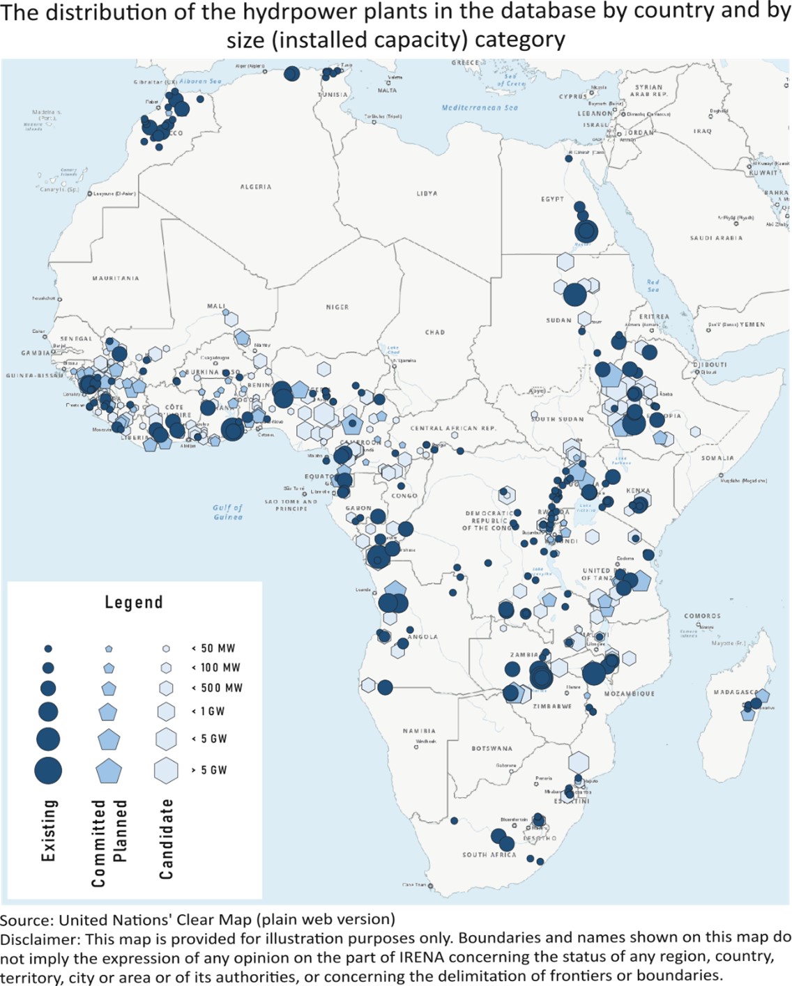
Hydropower resource is typically subject to strong seasonality, driven by rainfall patterns, snowmelt and other hydrological phenomena. Comprehensive databases of the seasonal availability of hydropower are currently not available to the community of power system modelers. Resultantly, hydropower plants are often represented in relatively coarse manners and without the necessary spatiotemporal detail in power system models which hampers research efforts to assess the spatiotemporal synergies with modern renewables like solar PV and wind. To close this gap in resources available to the modelling community, IRENA released a new spatiotemporal data atlas, titled African Renewable Electricity Profiles for Energy Modelling (AfREP) – Hydro, which covers all existing and several hundred committed, planned and potential future hydropower plants across the African continent.
The AfREP-Hydro database, which is fully based on openly accessible information, contains hydropower plants’ (i) geospatial references and the name of the associated river, (ii) status (existing, committed/ planned, candidate), (iii) technical characteristics (e.g. installed capacity, volumetric size of storage, design discharge), and (iv) seasonal (monthly) availability profiles for hydrologically normal years as well as anomalously dry and wet years - taking into account current and future river damming infrastructure – under present day climate and under future climate scenarios. The database can be visualized and downloaded from IRENA Global Atlas and the source code be accessed from zenodo.


